ALTA land survey - the standard for no-surprise headlines
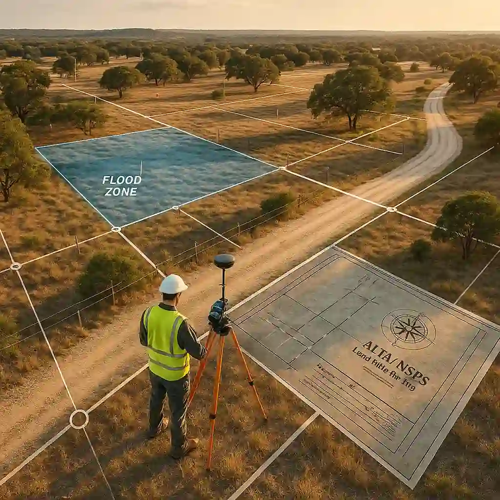
ALTA Land Survey: Securing Your Land Purchase in Texas
Purchasing land in Texas is a major investment that requires thorough due diligence. Among the essential tools at your disposal, the ALTA land survey stands as the gold standard for securing your real estate transactions. This detailed survey, developed jointly by the American Land Title Association and the National Society of Professional Surveyors, protects you from surprises and costly disputes related to property boundaries, easements, or encroachments.
Thibaut Guéant is the co-founder of LandQuire, a U.S. company specializing in high-yield real estate investment. A French entrepreneur who has been based in Miami for more than 10 years, he has raised more than $40 million since 2021 and led more than 130 real estate transactions across the United States.
What does ALTA land survey mean?
An ALTA land survey is a land survey that complies with the national ALTA/NSPS standard.
- ALTA = American Land Title Association (association of title companies)
- NSPS = National Society of Professional Surveyors (national association of surveyors)
This standard establishes uniform content and precision: legal boundaries, easements, access, encroachments, FEMA zones, optional "Table A" elements. It provides lenders, title insurers and investors with a common, verifiable legal-technical basis recognized throughout the United States.
LandQuire Expertise: A real estate team (property, data, entitlement) dedicated to French-speaking investors in Texas. We coordinate ALTA/NSPS surveys, title searches, and Table A to ensure smooth acquisitions. Talk to an analyst.
Key Takeaways (30 sec)
- The ALTA/NSPS Land Title Survey is the national standard required by lenders and insurers.
- The Tables A provide detailed information (zoning, utilities, FEMA, elevation data).
- Plan ahead 2 to 4 weeks and place your order as soon as the offer is accepted to avoid delays in closing the deal.
What exactly is an ALTA land survey?
This survey is much more than just a topographic map. It is a standardized document that meets strict requirements established at the national level. This standardization ensures that all parties involved in a real estate transaction—buyers, sellers, lenders, and title insurance companies—have access to the same accurate and verifiable information.
An ALTA survey identifies the legal boundaries of the property with centimeter-level accuracy. It also documents all physical features on the land: buildings, fences, access roads, utility lines, and significant vegetation. This level of precision helps prevent future disputes with adjacent property owners.
Quick survey comparison
| Statement type | Main object | Typical use | Required by lenders/insurers |
|---|---|---|---|
| Boundary survey | Property limits | Single-family homes | No |
| Topographic survey | Relief & physical features | Design / engineering | No |
| ALTA land survey | Boundaries + Titles + Easements + Access + Table A | Pro / institutional transactions | Yes (standard) |
Mandatory components of an ALTA survey
Each survey must include basic elements defined by national standards. The professional surveyor identifies and marks all corners and boundaries of the parcel with physical markers. He or she measures and maps existing buildings, determines their exact position relative to property boundaries, and verifies their compliance with zoning regulations.
The final document lists all registered easements, whether for the passage of public utilities, road access, or other rights of way. These easements in Texas can significantly affect the future use of your property. The survey also identifies any encroachments—that is, structures or improvements that extend beyond the legal boundaries of the parcel.
Setback lines imposed by municipal or county by-laws appear clearly on the plan. These buffer zones determine where you can build and directly influence the development value of your land. The surveyor also indicates existing rights-of-way and access roads that cross the property.
Why ALTA survey outperforms standard surveys
The fundamental difference between this survey and a standard topographic map lies in its precision. The ALTA/NSPS standards require a thorough review of public records, including property deeds, subdivision maps, and zoning documents.
This preliminary research enables the surveyor to compare physical boundaries with legal descriptions. Any discrepancies are identified and documented.
This reconciliation of land and records protects your investment against future legal uncertainties. It ensures that what you buy on paper corresponds exactly to the physical reality on the ground.
Enhanced protection for lenders and insurers
Financial institutions that provide real estate loans almost always require this type of statement. This document allows them to accurately assess the mortgage collateral and identify potential risks. Without this level of detail, a lender risks substantial losses if title issues arise after the loan is funded.
Title insurance companies use the survey to determine coverage exclusions. They may refuse to insure certain risks revealed by the survey or adjust their premiums accordingly. This transparency allows you to negotiate with the seller to resolve any issues before closing.
Optional items in Table A
The ALTA standards provide a list of optional items, known as Table A, that you can request based on your needs. These additional items help you better understand the property and reveal characteristics that could affect your development plans.
Option 1 requires the surveyor to verify any monuments found or placed at the corners of the property. Option 2 requires certification of compliance with local zoning regulations, including parking and density requirements. This verification saves you unexpected compliance costs.
Critical options for land investment
Option 3 requires the surveyor to identify encroachments, overlaps, or gaps in property lines between adjacent properties. These anomalies can lead to costly disputes or completely derail your construction plans. Option 6A certifies the location of underground utilities (water, sewer, gas, electricity) based on available information.
For a real estate investment in Seguin or elsewhere in Texas, Option 8 proves invaluable. It documents flood zones based on FEMA maps—crucial information that complements the analysis of FEMA flood zones. This knowledge influences your construction decisions and insurance costs.
Option 11 requires vertical elevation data for existing structures and critical terrain points. These elevation data determine natural drainage and areas susceptible to water accumulation. It completes your hydrological and geotechnical risk assessment.
The ALTA survey process
The process of creating an ALTA abstract begins with gathering documents. The surveyor obtains the current title deed, registered subdivision maps, legal descriptions, and any easement documents. This document-gathering phase can take several days, depending on the complexity of the property’s history.
In the field, the surveying team uses high-precision GPS equipment and total stations. They locate existing monuments, place new ones if necessary, and measure all physical elements. This field phase typically takes from one to three days for a standard residential property.
Deadlines and coordination with the transaction
It takes between two and four weeks to process the data and produce the final plan. This timeframe varies according to the size of the property, the complexity of the features and the workload of the surveying firm. For urgent transactions, some surveyors offer an accelerated service for an additional fee.
You must order the survey as soon as your purchase offer is accepted. Planning ahead in this way allows you to quickly identify any issues and negotiate solutions before the closing date. Any delay in ordering the survey may jeopardize your contractual deadlines and put your transaction at risk.
Coordination with your real estate attorney and your title agent is essential. They review the survey to identify legal risks and exceptions to the title commitment and title insurance. This joint review protects your interests and ensures a smooth closing without any surprises.
Save time on your due diligence: LandQuire coordinates certified surveyors, title searches, and Table A analysis to ensure the security of your acquisitions. Contact our experts.
Costs and variation factors
The cost of an ALTA land survey in Texas varies widely depending on several factors. For a typical residential property of less than two hectares in an urban area, expect to pay between $2,000 and $4,000. Larger rural properties can cost anywhere from $3,000 to $10,000 or more.
Dense vegetation increases costs, as it complicates access and visibility for measurements. Rough terrain with significant changes in elevation requires more measuring points and more working time. Geographical remoteness adds travel costs for the survey team.
Optional features and their impact on price
Each item in Table A that you select increases the total cost. A zoning certificate can add $500 to $1,000. Locating underground utilities generally costs an additional $300 to $800.
Elevation surveys for flood zone analysis add $400 to $1,200 to the cost. Despite these costs, the survey provides inexpensive protection compared to potential losses. Discovering after the purchase that a building encroaches on a neighboring property can cost you tens of thousands of dollars in legal fees.
Interpreting results: warning signs
A well-conducted survey can sometimes reveal problems that require immediate action. Property encroachments are one of the most serious red flags. If a structure on the seller’s property crosses the property line onto the adjacent lot, you’re inheriting a potential legal dispute.
Discrepancies between measured boundaries and the legal description of the deed raise questions of title. These inconsistencies suggest errors in previous surveys or undocumented boundary changes. Your attorney must resolve these discrepancies before closing to ensure the validity of your title.
Servitudes and hidden restrictions
Unregistered easements may appear on land in the form of power lines, pipelines or access roads used by neighbors. Even if they do not appear in the public records, these established uses can create rights by prescription.
Water rights in Texas deserve special attention if your property borders a watercourse or contains wells. The survey identifies these hydrological features but does not document the associated use rights. A separate search is required to secure your irrigation or domestic consumption rights.
Mining rights in Texas are another critical area not covered by the standard survey. If subsurface rights have been separated from surface rights, the holder of the mining rights may access your property for exploration and extraction. This essential verification requires a thorough title search separate from the survey.
ALTA survey and institutional due diligence
Institutional investors, particularly family offices in Texas, consider this report a non-negotiable part of their acquisition process. This rigor reflects their understanding of the hidden risks that can erode the value of a real estate asset.
These investors often order extensive optional items from Table A. They seek a comprehensive understanding of every physical and regulatory aspect of the property. This methodical approach minimizes post-acquisition surprises and protects their capital from unexpected depreciation.
Integration with title insurance
The survey works in conjunction with your title insurance policy. The insurer uses it to identify exclusions from coverage—that is, the specific risks it refuses to insure. Without a survey, the insurer lists general exclusions that offer little actual protection.
With a survey in hand, you can negotiate the removal of certain standard exclusions. If the document confirms that there are no encroachments or zoning violations, the insurer may offer expanded coverage. This negotiation enhances the value of your policy and strengthens the security of your investment.
The survey also enables the insurer to issue an access and entry endorsement. This endorsement certifies that the property has legal access to a public thoroughfare, an essential guarantee of constructability and market value.
2021 standards and recent developments
The ALTA/NSPS standards have been revised in 2021 to reflect technological advances and emerging best practices. These changes enhance the accuracy and usefulness of surveys for all stakeholders. Surveyors must now clearly identify the source and date of all data used.
Version 2021 imposes stricter requirements for utility documentation. Surveyors must contact utility companies and document their responses, even if no infrastructure is identified. This diligence reduces the risk of accidental damage to underground lines during future work.
Improved technology and precision
The widespread adoption of RTK (Real-Time Kinematic) GPS systems and 3D laser scanners has greatly improved the accuracy of surveys. These technologies capture millions of data points in just a few hours, creating detailed digital models of the terrain.
Unmanned aerial vehicles (UAVs) equipped with high-resolution cameras now make it possible to rapidly map vast properties. This aerial approach complements traditional ground-based measurements, revealing features that are difficult to observe at ground level. The drone images included in the final report provide a valuable visual context for the interpretation of technical data.
Common mistakes to avoid when ordering
Many buyers make the mistake of ordering a standard topographic survey instead of a complete ALTA survey. This apparent savings often turns into additional costs when the lender or title insurer rejects the incomplete document.
Another common mistake is omitting the relevant optional items from Table A. If your project involves construction, you need zoning and elevation verifications. For rural land, locating services and analyzing flood zones are crucial.
Neglecting to check qualifications
Not all surveyors have the expertise required to perform a survey that complies with national standards. Make sure the professional has a valid Texas license and specific experience with ALTA surveys.
An unqualified surveyor may produce a document that looks correct but omits critical elements or contains measurement errors. These defects only become apparent when problems arise, often after closing when your recourse is limited.
Post-acquisition preservation and use
Your statement retains its value long after the initial transaction. Keep several copies in secure locations (both physical and digital). This document will serve as a reference for all your development projects, permit applications, and future transactions.
When planning new construction or renovations, this plan guides the optimal placement of structures in compliance with setback lines and easements. Your architect and builder will use this plan as the basis for their own site studies.
Update for significant changes
If you make major changes to the property (new construction, subdivisions, boundary changes), you will need to have your survey updated. A surveyor can revise the existing document more quickly and at a lower cost than a completely new survey.
Lenders generally require a survey that is less than six months old for a refinance or a new loan. If your existing survey is older but the property has not changed, the original surveyor can often issue a recertification.
Resources and official sources
To deepen your understanding of ALTA standards and best practices in land surveying, consult these authoritative resources:
- American Land Title Association (ALTA): a professional organization that sets national standards for title surveys.
- National Society of Professional Surveyors (NSPS): an association that works with ALTA to define technical requirements.
- USGS, U.S. Geological Survey: reference topographic and cartographic data.
- FEMA Flood Map Service Center: official flood maps used in the Table A options.
Frequently asked questions about the ALTA land survey
What's the difference between ALTA land survey and boundary survey?
A boundary survey only delineates property boundaries. An ALTA survey includes comprehensive verifications of title, easements, access, FEMA zones, and Table A compliance. It is the standard required by lenders and insurers for professional and institutional transactions.
How long does it take to get an ALTA survey?
In general, allow 2 to 4 weeks depending on the size and complexity of the property and the Table A options selected. Anticipate the order as soon as you accept your offer to purchase to meet closing deadlines and avoid costly delays.
Do I need to order all Table A options?
No. Select the options according to your specific project: zoning and setbacks (option 2), encroachments (option 3), utilities (option 6A), flood zones and elevations (options 8 and 11). An experienced ALTA surveyor will help you target the elements relevant to your situation.
Further information
After the ALTA/NSPS Land Title Survey, the next logical step is entitlements (permits, site plans, utilities, phasing) to make the lots ready for construction.
Land Entitlement in Texas: Understanding, Planning, and Succeeding
An Essential Protective Investment
An ALTA title report is much more than just an administrative formality in your Texas real estate acquisition process. This tool reveals the physical and legal reality of your investment with a clarity that protects you from costly surprises.
For investors building a sustainable real estate portfolio, the survey forms the foundation of a thorough due diligence process. It works in tandem with your other due diligence steps—such as title searches, environmental analyses, and verification of water and mining rights—to provide a comprehensive picture of your asset.
By consistently requiring a title report that complies with the most recent ALTA/NSPS standards, you are adopting the best practices of financial institutions and institutional investors. You transform uncertainty into certainty, risk into security, and position your real estate portfolio on the solid foundation of accurate and verifiable information.
LandQuire expertise
This article is brought to you by LandQuire, a company specializing in real estate investment in Texas. Since 2021, we have assisted with over 400 investment projects for French-speaking investors. With a team of experts in real estate, data, and land entitlement, we structure transactions totaling several million dollars in assets.
Our mission: to ensure the security of your property purchases by eliminating risks related to easements, access rights, flood zones (FEMA), mining rights, and title defects.
Important Notice: Past performance and internal targets are not a guarantee; results are not assured. The information presented is for educational purposes only and does not constitute personalized legal, tax, or financial advice. Consult a qualified professional before making any investment decisions.
Need a reliable ALTA land survey before signing? Our team coordinates all aspects of your real estate due diligence in Texas: certified land surveyors, title searches, regulatory analysis, and rights verification. Contact our LandQuire analysts.
About the Author
Thibaut Guéant is the co-founder of LandQuire, a U.S. company specializing in high-yield real estate investment. A French entrepreneur who has been based in Miami for more than 10 years, he has raised more than $40 million since 2021 and led more than 130 real estate transactions across the United States.